SOTA Activation of Mt Dom Dom and Mt Strickland

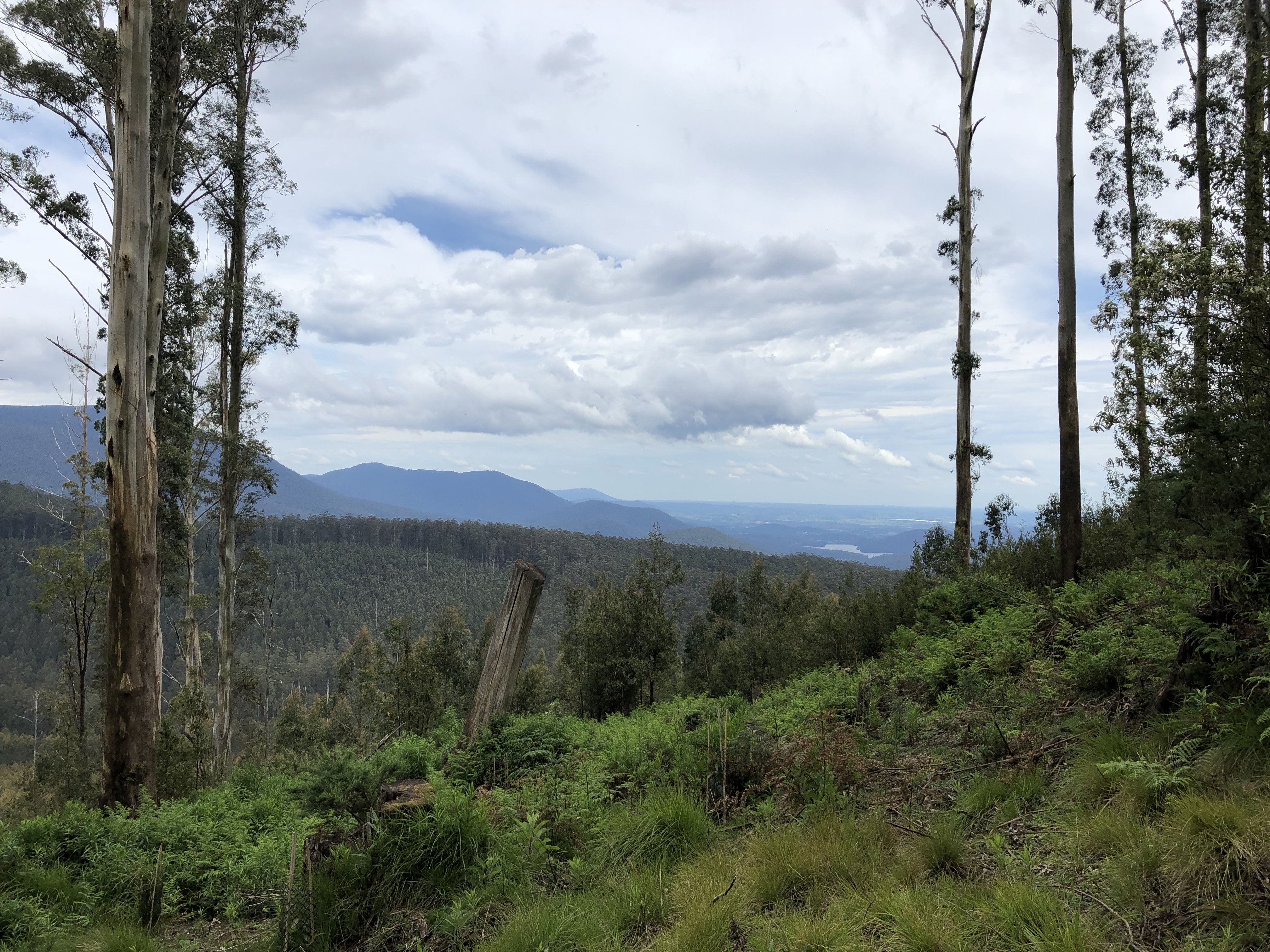
The best view from within the activation zone of Mt Dom Dom
Mt Dom Dom
Navigation
A turn off the Maroondah Highway at point 55H 380109 5838673 leads to the bottom of the summit via Road 8 and then Dom Dom Road to point 55H 381155 5838091, walking in from here. There is sufficient room to park a number of cars.
The Hike
The terrain is difficult, with a steep climb. Additionally loggers have made it impossible to 4WD up the mountain by digging enormous divots throughout the track, making it cumbersome to pass on foot. Soil from these divots is loosely piled. Passage is eminently possible but just makes it that much more difficult, and makes the mountain uglier for it.

One of a few lengths of track purposely destroyed by backhoe

Not a terrible environment once the man-made destruction of the track is passed. Looking down the track before the turnoff to the summit.
Summit Trek Map
Contacts
I struggled for contacts, possibly due to developing storms nearby.
It was great to get Andrew VK1AD on Mt Mundoonen VK2/ST-053. There was a fair bit of QSB to deal with, but we made it work.
| Time (UTC) | Callsign | Frequency (MHz) | Mode | Sent | Received | Notes |
|---|---|---|---|---|---|---|
| 00:19 | VK3LIT | 146.500 | FM | 5x8 | 5x4 | |
| 00:34 | VK1AD/P | 7.090 | SSB | 5x1 | 5x5 | S2S VK2/ST-053 |
| 01:06 | ZL1TM | 14M | CW | 539 | 429 | |
| 01:25 | VK3ZLD | 146.450 | FM | 5x6 | 5x9 |
Summit Notes
The very top of the summit is within scrub, and so activating a few metres down from the activation zone was necessary. This can give you good views into Melbourne and with a sufficiently elevated j-pole antenna, I was able to work some stations on FM.
Ratings
Ratings of the experience by my non-licenced partner
| Aspect | Rating | Notes |
|---|---|---|
| Drive (e.g. length, views) | | Taking the Black Spur isn’t a bad way to start an activation |
| Road quality (e.g. particularly considering off-road portions in a 2WD) | | Quite straightforward, not very bumpy |
| Hike | | Annoying at times, some small falls due to very loose surfaces |
| Summit entertainment (e.g. views, places to sit) | | Reasonable view however nothing to do but sit and read on a significant slope |
Mt Strickland
Navigation
From Mt Dom Dom I headed back towards the Maroondah Highway and then north towards Maryborough. I turned onto Acheron Way, then onto Feiglans Road at point 55H 385295 5836639 all the way to the T-intersection with Road 8. Turning left at Road 8, I reached the summit easily on a nice, well-graded 2WD track.
Contacts
I was in a rush due to weather, and (almost!) had a successful DX QSO on CW. YC2VOC from Indonesia had a great signal into Mt Strickland on 20m however I was confused by the callsign, absolutely not expecting to hear a YC call. As a result I did not successfully complete and log the QSO.
| Time (UTC) | Callsign | Frequency (MHz) | Mode | Sent | Received | Notes |
|---|---|---|---|---|---|---|
| 03:28 | VK1AD/P | 7MHz | SSB | 5x3 | 5x5 | |
| 03:32 | VK1MA | 7MHz | SSB | 5x7 | 5x6 | |
| 03:35 | VK3PF | 7MHz | SSB | 3x3 | 3x2 | |
| 03:36 | VK5PAS | 7MHz | SSB | 5x7 | 5x5 |
Summit Notes
The summit is a very clear area next to a well-graded 2WD road. Space abounds for large setups if required. There is no view to speak of, and the summit is reasonably protected from winds by woods ~50m either side.
Ratings
Ratings of the experience by my non-licenced partner
| Aspect | Rating | Notes |
|---|---|---|
| Drive (e.g. length, views) | | Very easy drive along Acheron Way, however need to pay attention for oncoming traffic |
| Road quality (e.g. particularly considering off-road portions in a 2WD) | | Quite straightforward, little bit long but otherwise pleasant |
| Summit entertainment (e.g. views, places to sit) | | Wide open space but no views or wandering potential |