TITLE: GPX files for Edinburgh cycle loops
DATE: 2024-10-27
AUTHOR: John L. Godlee
====================================================================
Here are some routes that I cycle fairly regularly in Edinburgh. I
cycle them predominantly on my single speed. There are occasional
sections where I would prefer something with wider tyres, but
nothing that requires a proper mountain bike. Most of the tracks
start around Holyrood Park, then head out of the city in different
directions.
I calculated the length of the GPX files in R:
# Packages
library(sf)
library(units)
# Conversion factor: km to miles
km_mi <- 0.6213712
# List GPX files
gpx_files_list <- list.files(pattern = "*.gpx")
# Read GPX files
gpx_list <- lapply(gpx_files_list, function(x) {
st_read(x, layer = "tracks")
})
names(gpx_list) <- gsub("\\.gpx$", "", gpx_files_list)
# Calculate lengths of GPX files
lapply(gpx_list, function(x) {
x_length <- drop_units(st_length(x))
x_length_km <- x_length * 0.001
x_length_mi <- x_length_km * km_mi
return(c("km" = x_length_km, "mi" = x_length_mi))
})
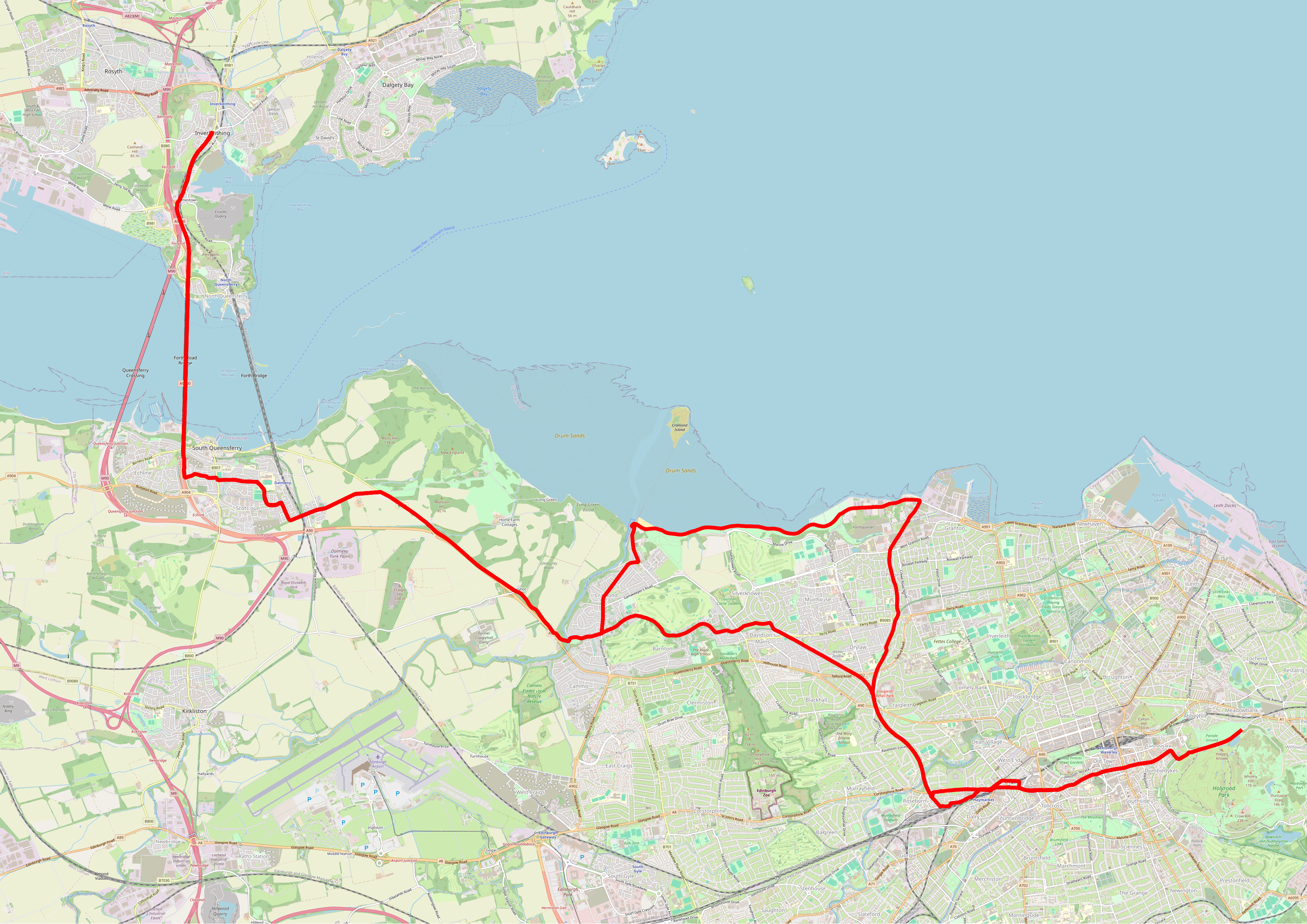
Inverkeithing
GPX track
[GPX
track](https://johngodlee.xyz/files/cycle_edinburgh/inverkeithing.gp
x)
Length: 52.2 km, 32.4 miles
This route heads north from Haymarket via the Roseburn Path down to
Granton, then west along the coast to Cramond along the promenade
along National Cycle-route 1, which follows the Roseburn path from
Haymarket. From Cramond the route then follows National Cycle-route
1 (NCR1) alongside the busy A90. Unfortunately there is a short
section of fast road between the B294 and Dalmeny, which makes this
route difficult after dark. The route then heads through Dalmeny to
Inverkeithing over the old Forth Road Bridge and back again to
Cramond. From Cramond back into town the route continues to follow
NCR1 to Haymarket, then through Grassmarket and down Cowgate back
towards Holyrood Park.
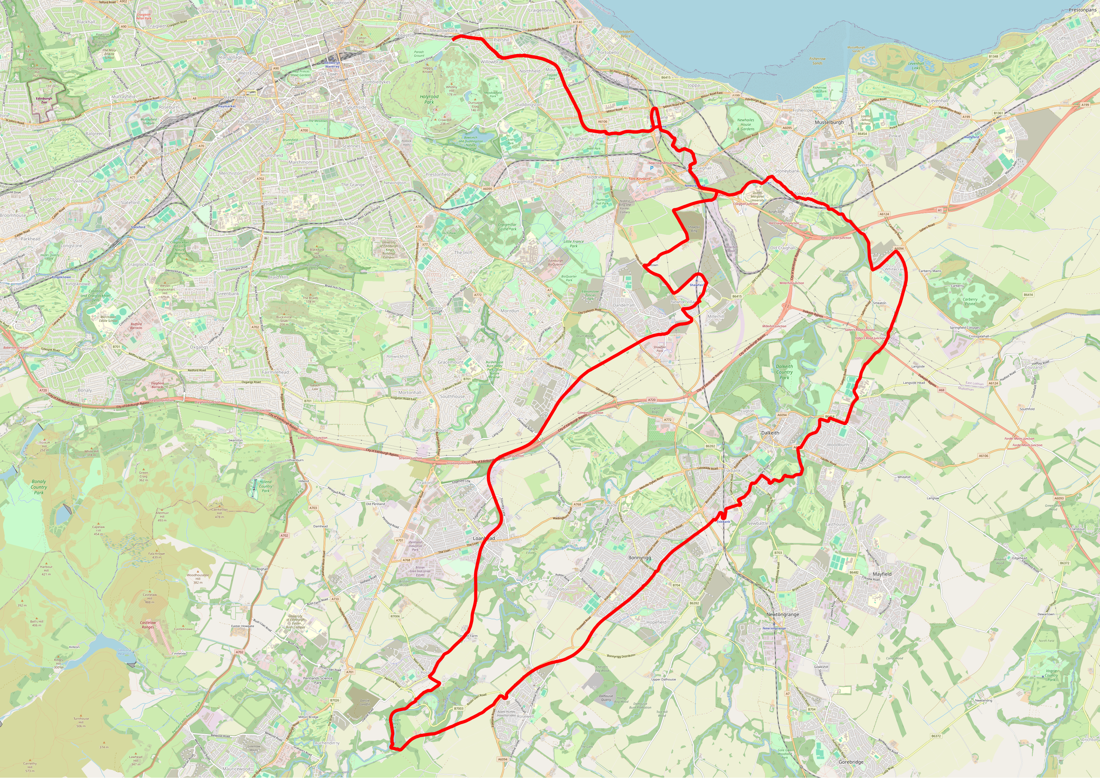
Musselburgh to Roslin via the Penicuik-Dalkeith Walkway
GPX track
[1](https://johngodlee.xyz/files/cycle_edinburgh/musselburgh_dalkeit
h_roslin.gpx)
Length: 47.4 km, 29.4 miles
I got the idea for this route from another route which goes all the
way down to Penicuik, but recently the Penicuik-Dalkeith Walkway
has been partially closed for resurfacing work. The route starts by
following NCR1 down toward the Jewel, then towards Musselburgh and
Queen Margaret University through winding housing estates. Then
towards Dalkeith and Bonnyrigg onto the Penicuik-Dalkeith Walkway.
Going through Roslin Glen there are a few walking sections, then
after Roslin village it's back on the cycle path, through Loanhead
to Newton Village and past Shawfair train station. The landscape is
very odd round here, with lots of abandoned farmland, abandoned
roads and buildings. The section between Newton Village and the
turn-off at Hilltown along the A6106 is quite nasty. I cycles along
the pavement. Beyond Craighall Junction the route goes the same way
as at the start.
[another route]:
https://www.cyclingscot.co.uk/blog/why-do-disused-railway-paths-alwa
ys-seem-to-be-located-in-the-most-stunning-scenery-edinburgh-to-peni
cuik-cycle-route
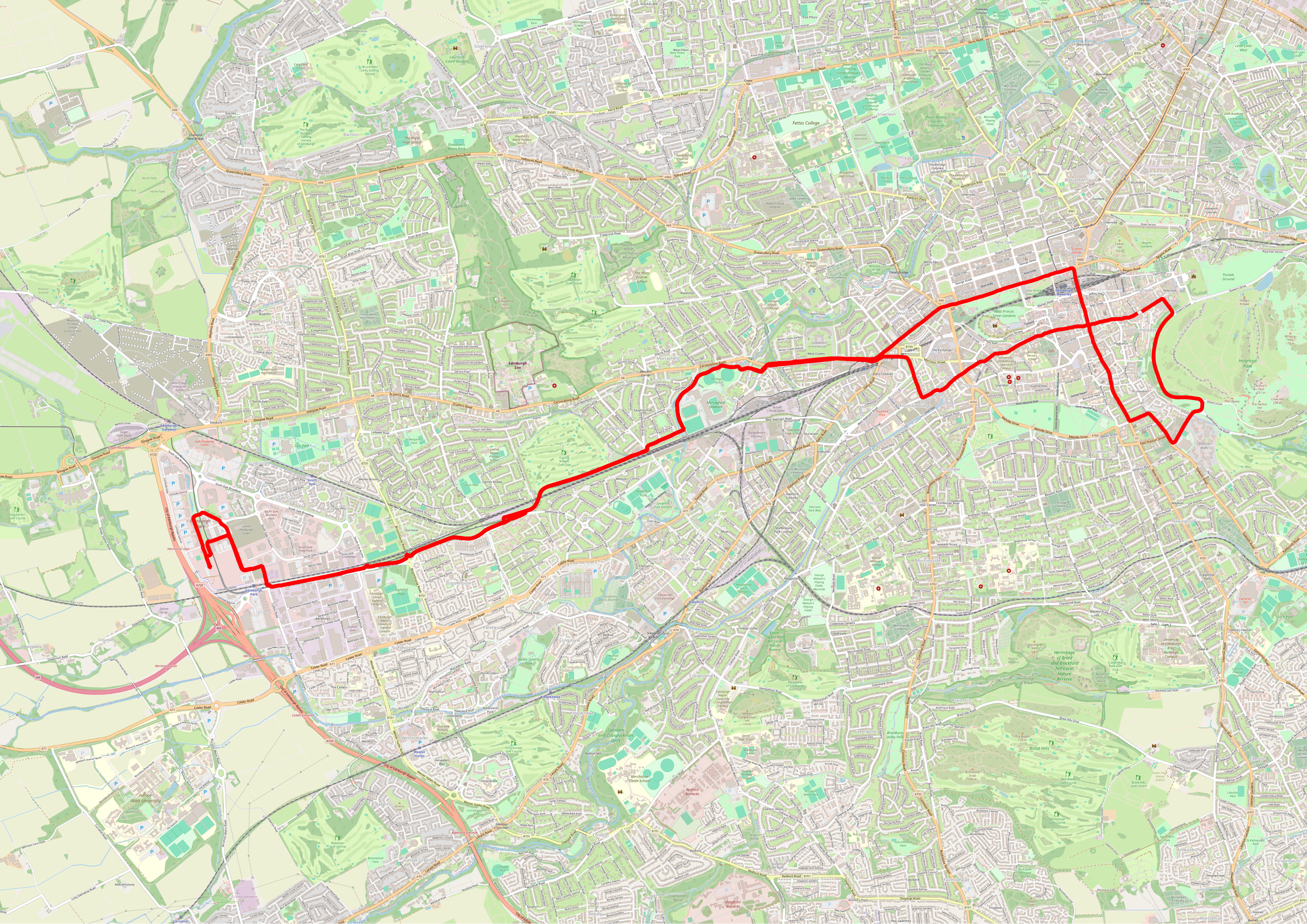
Patina bakery
GPX track
[2](https://johngodlee.xyz/files/cycle_edinburgh/patina.gpx)
Length: 24.6 km, 15.3 miles
This route worms through the middle of town towards Haymarket, then
through Murrayfield on the cycle path that follows the tramline all
the way to Edinburgh Park. Once in the business park there are
various roads that never have any traffic on them, which are good
for doing laps to extend the length of the ride a bit. Patina
Bakery is a good stop for a pastry or a pint in the adjacent
restaurant. The route through the centre of town could be varied,
for example to avoid Princes Steet, or to avoid Cowgate.
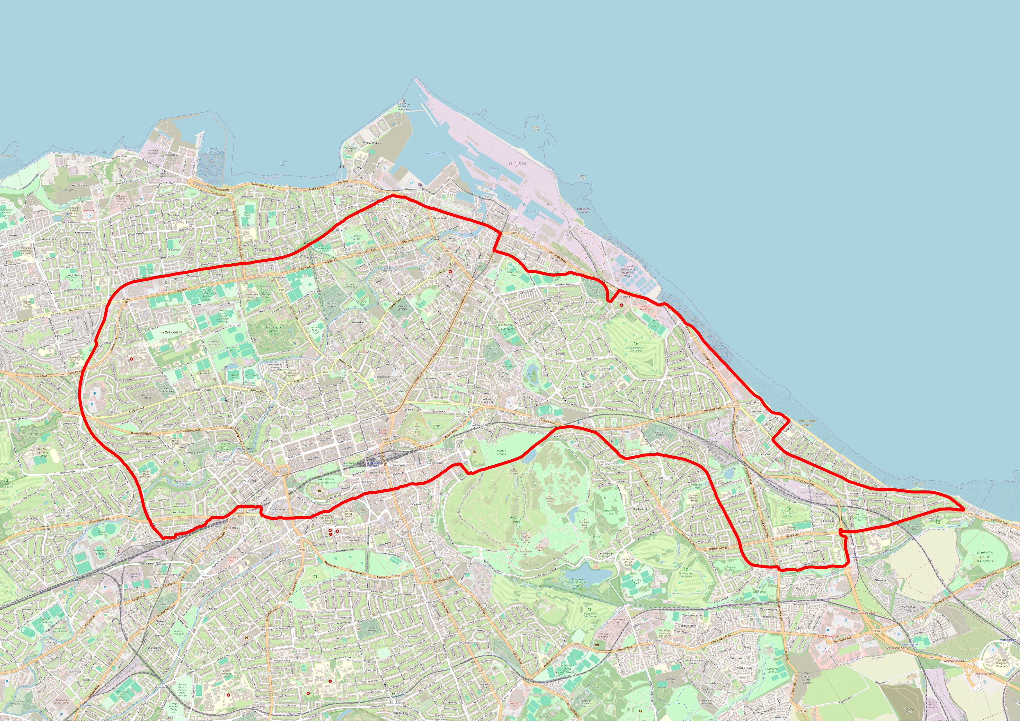
Portobello and the Roseburn Path
GPX track
[3](https://johngodlee.xyz/files/cycle_edinburgh/portobello_roseburn
_path.gpx)
Length: 26.8 km, 16.6 miles
This is my most frequent after work route. It starts of the road
down to Joppa, then along Portobello Road and onto the promenade to
follow the bike path road to Seafield. This section of the ride
isn't very pretty, but at least it's not on the busy road, as there
is a wide bike path that runs alongside. Through the Shore towards
the Roseburn Path is a fast road, but there's lots of space in the
bus lane. Once on the Roseburn Path the route is very pleasant,
though if doing this route at night it's vital to have a bright
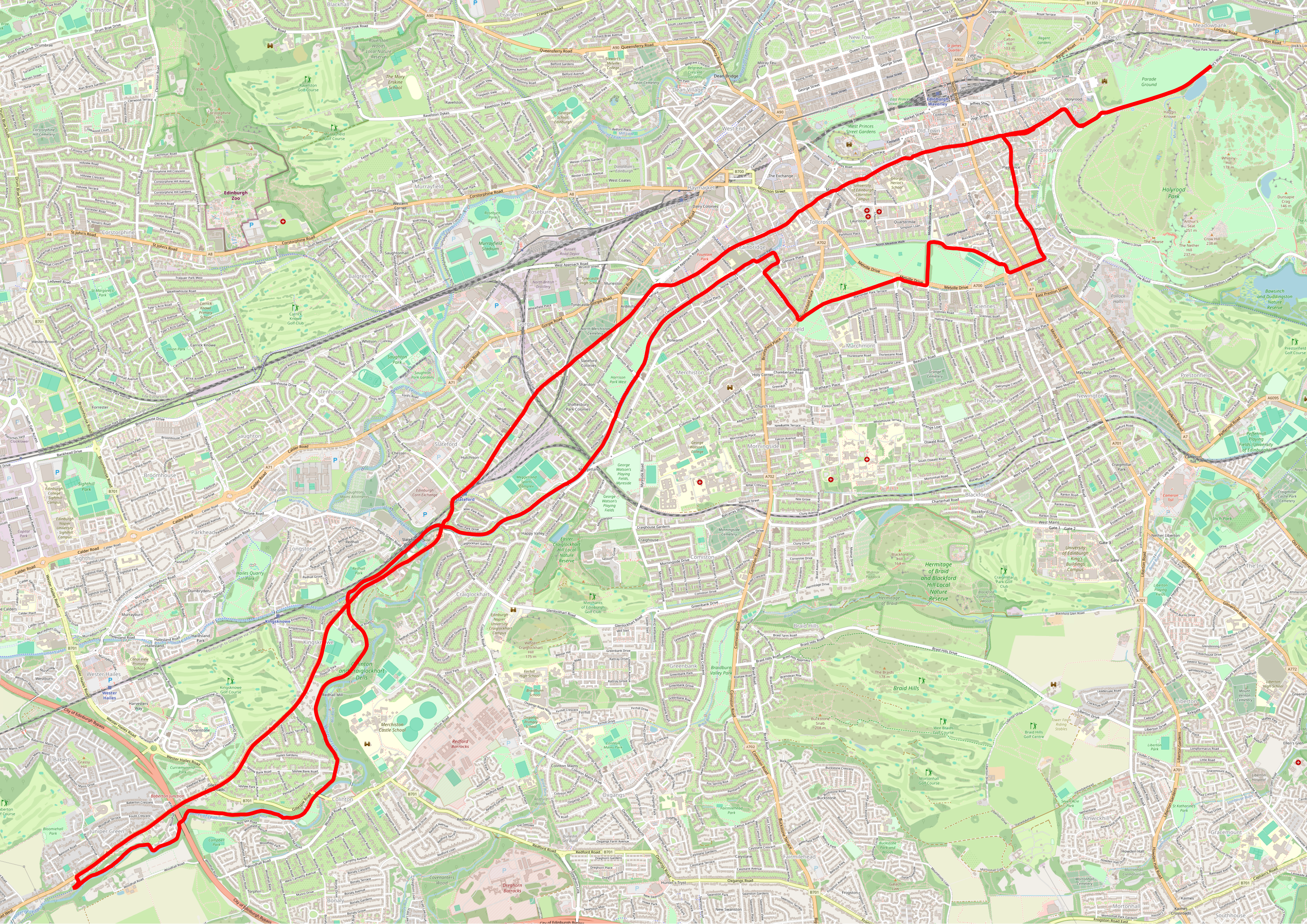
front light. From the end of the Roseburn Path back towards
Holyrood the route is very urban. I normally head through
Grassmarket and down Cowgate, but there are many ways of doing this
section.
Slateford climb and the Balerno cycle path
GPX track
[4](https://johngodlee.xyz/files/cycle_edinburgh/slateford_balerno_p
ath.gpx)
Length: 23.8 km, 14.8 miles
The entire purpose of this route is to do the long climb from
Slateford to Juniper Green along the A70. Much of this road now has
a segregated cycle lane, which makes it more pleasant, but it's
still a fast road. It's easy to miss the turn-off towards the
Balerno cycle path. It's also necessary to carry your bike down the
steps into the valley of the Water of Leith. Once on the Balerno
cycle path, proceeded by the Union Canal Path, the route is very
nice, though like the Roseburn Path it's important to have a bright
front light if doing this route after dark. When I recorded this
route I went up the hill to Bruntsfield Links before heading back
down to the Meadows because I wanted another climb, but you could
just take the junction at the end of Gilmore Place and onto the
cycle link on Valleyfield Street straight on to the Meadows.
